Forecast: March 3rd, 2023
Updated: Sep 3
Hey Huskies! Hope everyone had a smooth start to March and a good week 9! March 1st marked the start of meteorological spring, yet temperatures have sure not felt like it. But I’m not complaining of some extra rain and cool temps! 🌧️
So far this week we have seen below average temperatures continuing, with the low overnight on March 1st dipping below freezing at 28 degrees, much lower than the normal beginning of March lows of around 38. This could set us up for another pattern of below average temperature this month.
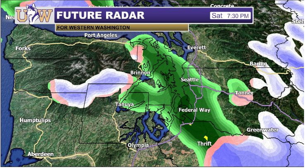
For today we have an upper-level trough hanging around, bringing us scattered, light precipitation throughout the day, with high temperatures hanging around the low 40s and overnight lows pushing subfreezing temperatures. Falling precipitation can be expected to be rain, since temperatures are hanging mostly above freezing, but overnight to early morning when temperatures are lingering around freezing and snow levels drop, some flakes may be seen at times, but most likely just in the higher elevations. Most of the snowfall will be in the mountains, as by the end of the weekend, totals at Stevens Pass and Mt Baker are expected to approach almost 2 feet. ❄️☁️

Here’s some of what we could see later tonight:

For this weekend we can expect this active weather period to continue, as precipitation continues to fall throughout Saturday. Cloudy weather with possible showers is expected to continue into Sunday, with sunbreaks possible at times (the best day for any outdoor endeavors🌤️), Then we see partly sunny weather return on Monday and Tuesday. So, hang in there for some drying and sun! Overall, cooler temperatures continue, encouraging the beginning of our below-normal temperature month. 😄

Well Huskies, hope everyone has a good weekend and a smooth last week of the quarter! Hang in there for spring break. 🌸


Comments